
CoastLens / Documentation
How it works
How CoastLens turns two survey epochs into a reviewed, signed and independently verifiable volume figure.
Overview
CoastLens runs five steps in order. Each one writes a record, so a signed report can always show its inputs, its arithmetic and the people who approved it.
| Step | What happens | What is recorded |
|---|---|---|
| 1. Input | Surfaces are uploaded with a declared vertical datum | File SHA-256, datum, stated uncertainty |
| 2. Quality gates | Datum, grid, coverage and no-data are checked | One result per check; refusals with a reason code |
| 3. Computation | ΔV is computed between two epochs | Raw and corrected volume, bias, area, cells, tolerance |
| 4. Review | Findings are accepted or dismissed by a named reviewer | Reviewer, decision, reason code, time |
| 5. Seal | The report is signed and sealed | Content hash, version, signer |
1. Input
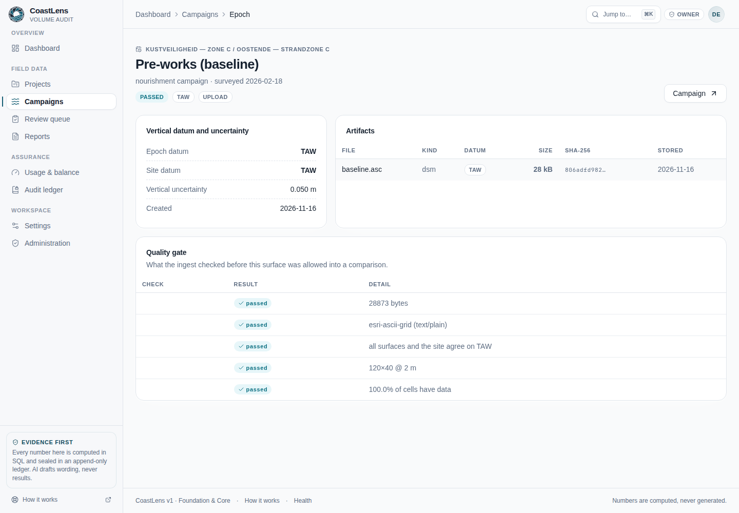
Each survey epoch belongs to a site and declares its vertical datum and its stated vertical uncertainty. Supported datums are TAW, NAP, LAT, MSL, ODN, chart datum, or a named local project datum.
Supported files
| Format | Used for |
|---|---|
ESRI ASCII grid (.asc) | Volume and transect computation |
| GeoTIFF / COG | Stored and fingerprinted as evidence (not yet read by the volume computation) |
| LAS / LAZ point clouds | Stored and fingerprinted as evidence |
| JPEG / PNG imagery, CSV, PDF | Stored and fingerprinted as supporting evidence |
Refused uploads
- A surface with no declared datum.
- A file whose format cannot be recognised.
- An elevation grid with no stated origin, because it cannot be shown to cover the same ground as another epoch.
CoastLens does not run photogrammetry. Bring a processed surface, not raw photographs.
2. Quality gates
Before any arithmetic runs, both epochs are checked. If a check fails, no volume is produced and the response names the rule that failed.
| Check | Fails when |
|---|---|
| Datum | The two epochs declare different datums, or one declares none |
| Grid | Grid shape or cell size differ between epochs |
| Coverage | The epochs do not overlap the area of interest |
| Control zone | The control zone contains no usable cells |
3. Computation
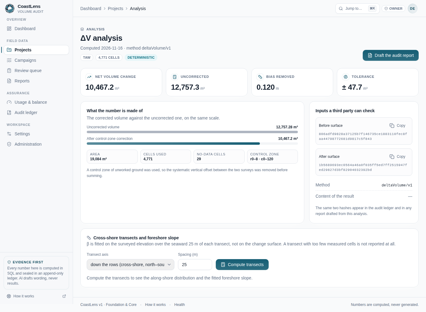
Volume change is the summed vertical difference over the area of interest, multiplied by the cell area. A control zone of stable ground is used to estimate the systematic vertical offset (bias) between the two surveys, which is then removed:
ΔV = Σ ( z_after − z_before − bias ) × cellAreaThe computation is deterministic and runs in code. Every result records:
- the corrected volume and the uncorrected volume;
- the bias removed by the control zone;
- the analysed area and the number of cells used and excluded;
- a tolerance band propagated from the stated uncertainty of both inputs.
Cross-shore transects can be added to show profiles and foreshore slope along fixed lines.
4. Review
Structural observations, such as a displaced armour unit or spalled concrete, are recorded as findings with the status proposed. A reviewer then accepts or dismisses each finding.
- The person who proposed a finding cannot approve it.
- Dismissing a finding requires a reason code from a fixed list (for example not a defect, below threshold, photo artefact, duplicate).
- The reviewer, the decision, the reason and the time are recorded.
5. Seal and verification
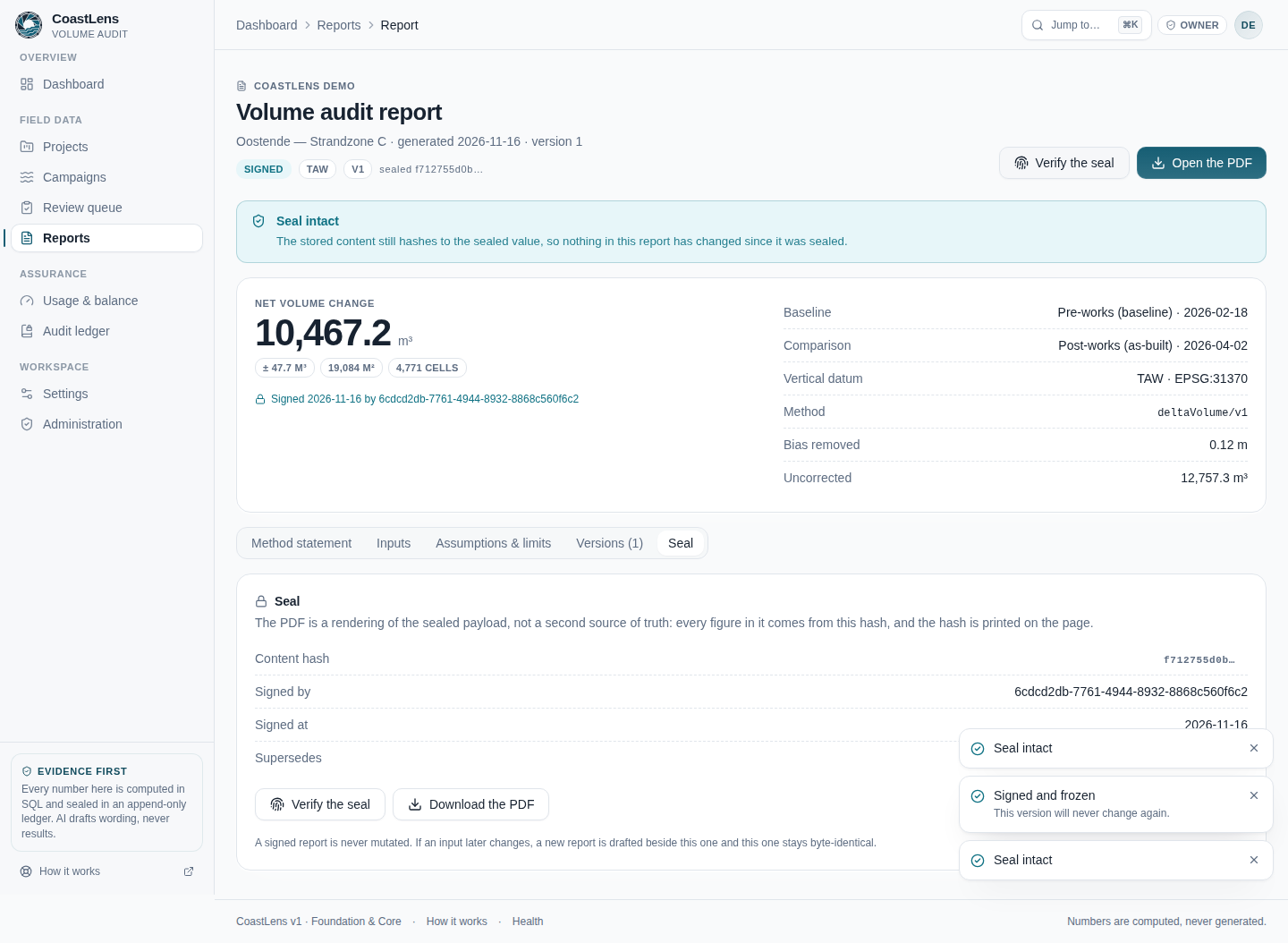
Signing a report writes its content hash, method version, input file hashes, reviewer and signer to an append-only, hash-chained ledger. Each ledger entry commits to the one before it, so editing an earlier entry breaks every later hash.
- A signed report cannot be edited. Changes create a new version; the earlier version stays intact.
- A third party can recompute the content hash to confirm the report has not changed since it was signed.
- The PDF is a rendering of the sealed report, not a separate source of truth.
How AI is used
A language model may draft the method statement of a report from a structured set of facts taken from the analysis. Before the draft is stored:
- every figure in the text is checked against the analysis;
- a figure that is not in the analysis, or certification or guarantee language, rejects the whole draft;
- a rejected draft is replaced by a fixed template.
No model computes, adjusts or certifies a volume. The report states whether its method statement was written by the model or by the template, and the report never depends on the model being available.
Limits
- Accuracy. No headline accuracy figure is published, because none has been measured on real survey data. The demo site is synthetic so its computed volume can be checked against a known analytic value.
- Scope. CoastLens does not fly drones, run photogrammetry or extract satellite shorelines.
- Certification. CoastLens documents evidence and decisions. It does not certify compliance or replace professional responsibility.
Data and billing
- Surfaces and records belong to your organisation and are visible only to its members, according to their role.
- Uploads are validated before storage and never executed.
- Usage is billed pay-as-you-go through the Sensifai Marketplace, per completed volume analysis. Your balance is shown on the dashboard.